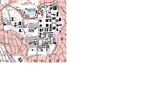
1. The name of the quadrangle is "Beverly Hills" located in California, Los Angeles
2. The names of the adjacent quadrangles are: Canoga Park, Van Nuys, Burbank, Topanga, Hollywood, Venice and Inglewood.
3. The quadrangle was first created in 1966
4. The datum used to create this map is:
Vertical datum: North American datum of 1927
Horizontal datum: North American datum of 1983
5. The scale of the map is 1:24000
6. a) 1cm on the map is 24000cm or 240m on the ground. Therefore, 5cm is 240*5 = 1200m
b) 5 inches is 120000 inches on the ground or 120000/63360 = 1.89 miles
c) 1 mile or 63360 inches on the ground is 63360/24000 = 2.64 inches on the map
d) 3 km or 300000cm on the ground is 300000/24000 = 12.5 cm on the map
7. The contour interval is 20 feet
8. a) Public affais building: 34 degrees, 4'40''N and 118 degrees, 26'25'' W or 34.078 degrees N, 118.44 degrees W
b) Santa Monica Pier: 34 degrees, 0'30''N, and 118 degrees, 30'0''W or 34.01 degrees N, 118.5 degrees W
c) Upper Franklin Canyon reservoir: 34 degrees, 7'0'' N and 118 degrees, 24'30'' W or 34.12 degrees N and 118.408 degrees W
9) a) Greystone Mansion: 520 feet
b) Woodlawn cementary: 140 feet
c) Crestwood Hills Park: 700 feet
10) The UTM zone of this map is 11
11) The UTM coordinates for the lower left corner of the map is 3762800 N 361500 W
12) We know that we get a 1000 meter increment as we change UTM grid lines one by one for both the latitude and the longitude. Therefore, the area of the lower left corner will be:
(3764000-3762800)*(362000-361500) = 1200*500 = 600000 m^2
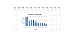
13) Attached
14) The magnetic declination is 14 degrees
15) The water flows from North to South
16) Attached
13) then 16)


No comments:
Post a Comment