Tuesday, April 13, 2010

Lab 3 Digital Maps


View The biggest tennis tournaments in the world in a larger map

Neogeography means "new geography". To be more precise, and from the definition on Wikipedia, it is "the application to the usage of geographical techniques and tools used for personal and community activities or for utilization by a non-expert group of users". When we think about it, we use neogeography in our everyday lives. For example, when we want to go to public affairs to do the lab for geography 7, we walk through bruinwalk, then walk towards North Campus to reach Bunch, then Public affairs. However, there are many paths to get there and all of us have different paths. This is why we have neogeography. We use a map and we make our decisions on what directions to choose to go from place to place. However, we do not necessarily have to have our own map. We could make our own map.
In the lab we did today, the only map I used was the map of the Earth given by Google Earth. However, I could have done this entire lab by having me draw a map of the Earth and do the lab. This is a form of neogeography. Adding information like I did on a blank map like the whole class did is also a form of neogeography. We are not experts on the matter but we add information to a map that does not have this information and that could be useful for anyone interested in the matter. For my lab, if someone likes traveling all over the world and has a passion for tennis, then the map I created will be very useful for that person. He will realize that the main spots for the biggest tennis tournaments will be in New York, Paris, London and Melbourne. The map I created is not available anywhere and this is what makes neogeography so useful in addition to the help of the Internet. With the help of the Internet, any information about any type of map is available within a few clicks.

Neogeography has always been useful in the past. However, when the Internet became popular, neogeography has really been fostered and we all see why it is useful in our everyday lives. Neogeography has also helped create the GPS, which is by far the most important tool if anyone needs to travel to a certain place without having the knowledge of the place. As the technology will continue to evolve, neogeography will become even more useful in the future even though it already is essential to everybody's lives today.

Friday, April 9, 2010

Lab 2

1. The name of the quadrangle is "Beverly Hills" located in California, Los Angeles

2. The names of the adjacent quadrangles are: Canoga Park, Van Nuys, Burbank, Topanga, Hollywood, Venice and Inglewood.

3. The quadrangle was first created in 1966

4. The datum used to create this map is:

Vertical datum: North American datum of 1927

Horizontal datum: North American datum of 1983

5. The scale of the map is 1:24000

6. a) 1cm on the map is 24000cm or 240m on the ground. Therefore, 5cm is 240*5 = 1200m

b) 5 inches is 120000 inches on the ground or 120000/63360 = 1.89 miles

c) 1 mile or 63360 inches on the ground is 63360/24000 = 2.64 inches on the map

d) 3 km or 300000cm on the ground is 300000/24000 = 12.5 cm on the map

7. The contour interval is 20 feet

8. a) Public affais building: 34 degrees, 4'40''N and 118 degrees, 26'25'' W or 34.078 degrees N, 118.44 degrees W

b) Santa Monica Pier: 34 degrees, 0'30''N, and 118 degrees, 30'0''W or 34.01 degrees N, 118.5 degrees W

c) Upper Franklin Canyon reservoir: 34 degrees, 7'0'' N and 118 degrees, 24'30'' W or 34.12 degrees N and 118.408 degrees W

9) a) Greystone Mansion: 520 feet

b) Woodlawn cementary: 140 feet

c) Crestwood Hills Park: 700 feet

10) The UTM zone of this map is 11

11) The UTM coordinates for the lower left corner of the map is 3762800 N 361500 W

12) We know that we get a 1000 meter increment as we change UTM grid lines one by one for both the latitude and the longitude. Therefore, the area of the lower left corner will be:

(3764000-3762800)*(362000-361500) = 1200*500 = 600000 m^2

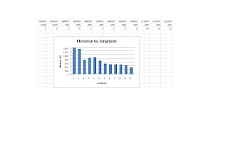
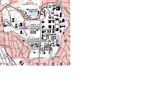
13) Attached

14) The magnetic declination is 14 degrees

15) The water flows from North to South

16) Attached


13) then 16)